B2 · 5 dk okuma · 590 kelime ·
Piri Reis and His Famous Map
Piri Reis ve Ünlü Haritası
Görsel: Piri Reis (Public Domain), wikimedia commons
önce İngilizcesini oku
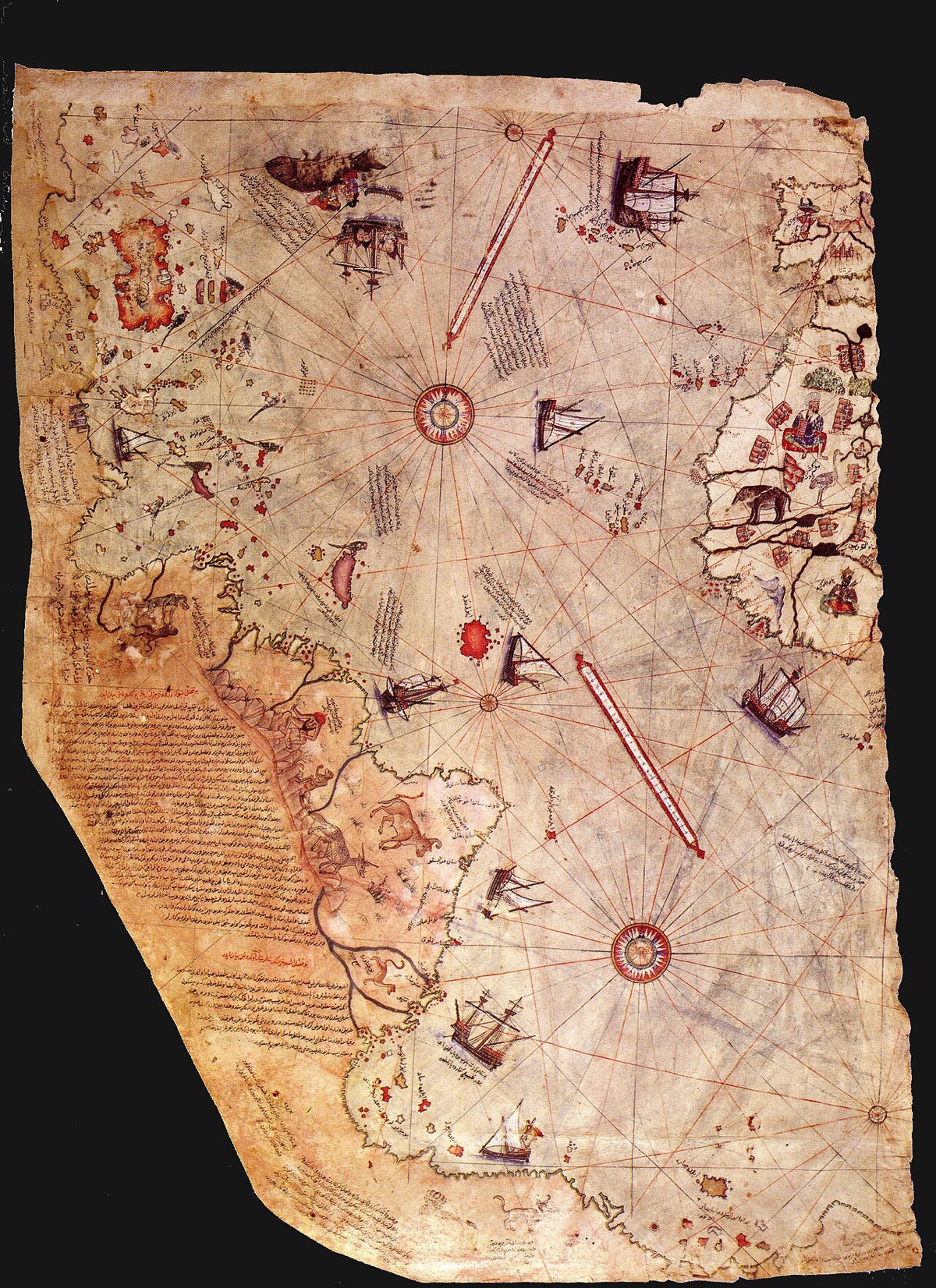
In 1929, while the old library of Topkapi Palace in Istanbul was being turned into a museum, a historian found something remarkable among the dusty documents.
It was a piece of a world map, drawn on gazelle skin and decorated with ships, animals and small notes.
The historian who found it, a German scholar named Gustav Adolf Deissmann, immediately understood how important it was.
The map had been made in 1513 by an Ottoman sailor named Piri Reis, and it soon became one of the most famous maps in the world.
Piri Reis was born in Gallipoli, a town on the Dardanelles, around 1470.
As a young man, he sailed across the Mediterranean with his uncle, Kemal Reis, who was one of the best known captains of his time.
Their ships visited many ports, from the islands of the Aegean Sea to the coasts of Spain and North Africa.
During these long voyages, he studied coasts, harbors, winds and currents, and he collected every map and piece of information he could find.
He later became an admiral, but he is remembered above all as one of the greatest map makers of his age.
Only about a third of his world map has survived to the present day, and the rest is lost.
The surviving part shows the western coasts of Europe and Africa, the Atlantic Ocean with its islands, and the coast of South America.
This makes it one of the oldest surviving maps in the world to show the Americas, drawn just twenty years after Columbus reached them.
The map also includes small drawings of animals that sailors had described, together with notes about the islands and what could be found on them.
In the notes on the map, Piri Reis explained that he had used about twenty older maps as sources.
One of them is said to have been a map drawn by Columbus himself, which has since been lost, so the Piri Reis map may preserve information that exists nowhere else.
Over the years, the map has also attracted some strange theories.
A few popular books claimed that its southern part showed the coast of Antarctica without ice, which would have been impossible in 1513.
Historians explain that the coastline is simply South America, bent to fit the edge of the gazelle skin, a common practice when space ran out.
There is no evidence at all for the idea about Antarctica.
The real story is impressive enough without any mystery.
Piri Reis also wrote the Kitab-ı Bahriye, or Book of the Sea, which he completed in 1521 and later improved.
It is a detailed guide for sailors, with many charts of the Mediterranean that show islands, harbors, safe places to anchor and dangerous rocks.
The book also gives advice on using a compass and reading the stars, and some copies begin with a long poem about the sea.
For centuries, copies of the book were used by captains, and today they are kept in libraries around the world.
In 2013, the five hundredth birthday of the world map, UNESCO added the anniversary to its list of important world anniversaries.
The original is so fragile that it is kept in the palace and rarely shown to the public, but copies of it can be seen in many museums and schools in Turkey.
In Turkey, his name has been given to a research ship, schools and streets, and his map has appeared on stamps.
Five centuries later, the work of a curious sailor from Gallipoli still makes people look at the world with fresh eyes.
Arkadaşınla paylaş
Bu yazıdaki gramer
Metinde gördüğün yapıları ücretsiz derslerle öğren.
Ücretsiz test
İngilizce seviyeni 5 dakikada öğren
Ücretsiz gramer testi: hangi derslerden başlaman gerektiğini söyler.
Testi çöz